Snowstorm will bring good money to Tahoe
Tahoe digging out after massive storm
Palisades Tahoe got eight feet of snow during the storm over the weekend. Crews have been working day and night to dig the Tahoe region out from the snow.
LAKE TAHOE, Calif. - This past weekend's big snowstorm had a big impact on the snow pack.
Palisades Tahoe, which was closed since Friday, got eight feet of snow during the storm.
"It's a behemoth of a snowstorm. But, our crews are ready. They've been out there working day and night," said Palisades Tahoe spokesperson Maddy Condon.

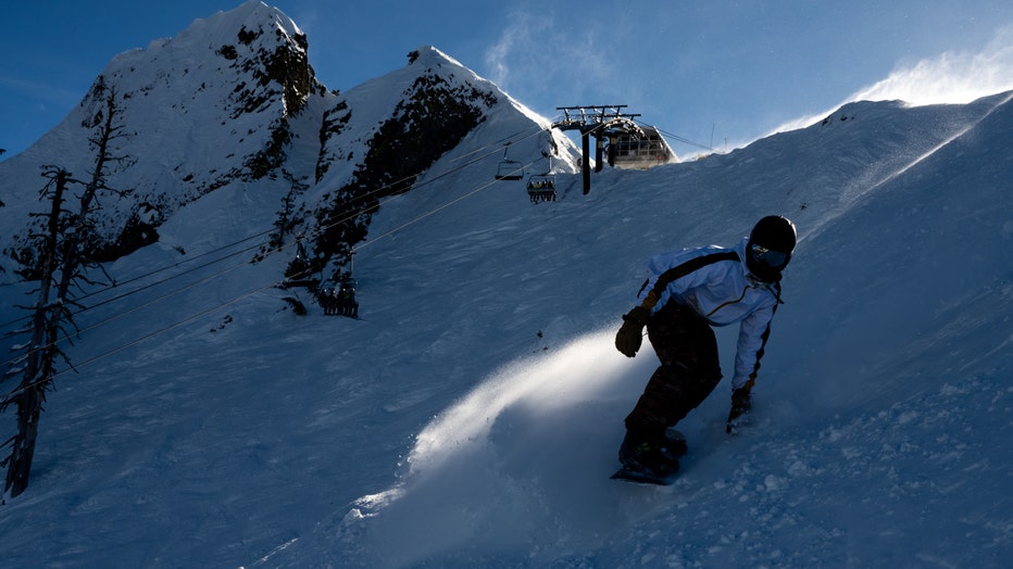
A snowboarder at Palisades Tahoe ski resort in Olympic Valley, California. The parade of storms provided a needed boost to the state's snowpack, a major source of drinking water.t. Photographer: Marlena Sloss/Bloomberg via Getty Images
On Sunday, there were mountaintop winds of 190 miles an hour; the highest reaching hurricane category.
"Today, we have part of our lower mountain at Palisades open and part of our Alpine side lifts open. There is still so much work to be done," said Condon.
With this storm, Palisades, already called the 'spring skiing capitol', will be open until very late in May. "There is always the potential to get that pushed. Last year with 723 feet of snow, we skied until the 4th of July," said Condon.
Traffic-wise, Highway 50 is open. Interstate 80 opened early Monday for automobiles only. Big rigs were permitted in the afternoon. But Monday evening will see snow again. "Overall, it's not a major concern for us, definitely for what we just saw," said Caltrans spokesperson Jeremy Linder.
For drivers, however, expect cleanup crews working 24/7 as well as this. "Expect chain controls, I don't expect those lifting today by any means. But you can make it through," said Linder.
That said, Tahoe is open for business. "The roads and the town are like clear. We have a lot of snow. The last couple days have been great. So, it is a miracle March year, so everything is going great," said Anda Santillan, manager of Rip N Willies Ski Shop.
Featured
Blizzard conditions, monster winds and whiteouts continue in Tahoe
Blizzard conditions and whiteouts with multiple feet of snowfall in the Lake Tahoe region continued on Saturday. As many as 10 feet of snow is expected to fall in some of the higher elevations of the Sierra by the end of the weekend.
Skiers already here at south shore tell Rip N Willies Ski Shop this. "The conditions are great. There's fresh powder every morning because of the storm that's been here and Heavenly and lie all the resorts have done a great job opening as early as they can," said Santillan.
What is the long-range forecast? "If we have an average next few weeks, we'll actually beat the typical peak of the snowpack, compared to historical data," said NOAA National Weather Service forecaster Chris Smallcomb.
As of Monday, the snow pack is already 119% of average on this date with the water content 98% of average. Big atmospheric river storms are still possible. "I'd say the next three to four weeks are gonna be really critical for what we get in the snow pack in total in terms of those big, juicy storms," said Smallcomb.
Finally, the 30 largest reservoirs are well above average for this date.


