KTVU flies with Air Force 'Hurricane Hunters' into eye of tropical storm
SANTA MARIA, Calif. - Whenever a significant weather system looks to make landfall, the 53rd Reconnaissance Squadron of the United States Air Force Reserves has a job.
Simply known as "Hurricane Hunters," the unique team from the U.S. Air Force Reserves spent the weekend flying into the eye of what is now Tropical Storm Hilary; at the time of their flights, it was as strong as a Category 4 hurricane.
KTVU's James Torrez was the only local reporter to ride along with the Hurricane Hunters, joining their fifth and final flight to the storm's center.
One of the pilots of the WC-130J aircrafts, Lt. Zach McDermott, says this job is perfect for him.
"I was growing up in Florida, went through a lot of hurricanes, saw the impacts of them, so when I found out about this mission, it's something that really spoke to me," he said.
He's one of five Hurricane Hunters on the flight. They took off Saturday evening from the Santa Maria Public Airport in Southern California and didn't return to ground until 2 a.m. Sunday morning.
It's the first hurricane headed for California crews have ever flown.
"Those usually stay off of Mexico," explained McDermott. "They don't typically go this far north."
Featured
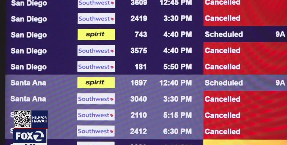
Tropical Storm Hilary forces slew of Bay Area flight cancelations
Tropical Storm Hilary is expected to have a major impact on air travel across the country, especially in California.
Headquartered in Biloxi, Mississippi, the squadron recently flew off the Pacific Coast at the start of the year, flying over atmospheric rivers headed to the Bay Area.
From Santa Maria, it took about two hours to get to Hilary. Once they detected rain, crew members launched "dropsondes," a tube-like tool that immediately measures the storm. It records data like wind direction, wind speed, and temperatures. That information is then immediately sent to the aircraft when the device hits the ocean water.
The flights cruise at an altitude of 10,000 feet. That's about a third of what you would normally fly in a commercial airplane.
To get the data, the Hurricane Hunters must fly through the eye of the hurricane. However, on this flight, they had trouble finding the eye.
"There's not a big radar signature anymore," said Lt. Col. Tobi Baker, the flights' Aerial Reconnaissance Weather Officer.
"The winds are getting less, the pressure is starting to increase a little, so it's starting to deteriorate now."
Before the flight, Hurricane Hilary was a category 2 storm. It was downgraded to a Category 1 while the aircraft was midair.
The National Hurricane Center is behind all the data collection. NHC experts say it helps improve their storm prediction accuracy by as much as 40%. The information also helps local officials determine how much of a threat the storm is and whether evacuations are necessary.
The NHC also dictates how many times the crews need to fly through the eye, called a "fix." The mission with KTVU required two fixes.
The five-member crew part of this flight acknowledges it is not a job for everyone.
"It does take a little bit of grit to get there," said Lt. Col. Baker. "Not everybody wants to fly straight into something that is a powerful mechanism that Mother Nature pushes out."
The Hurricane Hunters will head back to Mississippi Monday morning.


